

UAV Operations/Remote Sensing
UAV SYSTEMS ENGINEERING- OPERATIONS/REMOTE SENSING
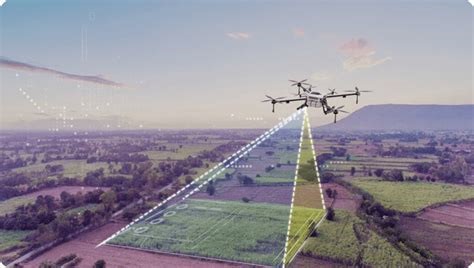
PSCI is highly proficient in UAV remote sensing operations, leveraging advanced sensor technologies and data analytics to support mission-critical applications in defense, environmental monitoring, infrastructure assessment, and intelligence. Our team utilizes multispectral, hyperspectral, LiDAR, and thermal imaging payloads to capture high-resolution geospatial data with precision and accuracy. We operate in full compliance with FAA Part 107 regulations and adhere to geospatial data standards set by the Federal Geographic Data Committee (FGDC) and the U.S. Geological Survey (USGS). Our capability in integrating UAV platforms with GIS and remote sensing software ensures actionable intelligence and decision support for government and commercial stakeholders, reinforcing our reputation for reliability, compliance, and innovation in aerial data operations.